|
Cruising Log: 7/1/04 - 7/6/04
|
We wanted to get away from it all for the 4th of July weekend, not
normally being interested in the hype, hubbub, and mayhem of ordinary
4th celebrations. With 4 days and an extra night at our disposal,
we decided to head slightly further afield than we might have for a
normal weekend.
I had fond memories from the early '80s
of the Cross River, located far up the Sheepscot River, near Wiscasset
and Boothbay. I thought it would be fun to go there; plus, as far
off the beaten path as it is, I figured it would probably be
uncrowded. With a decent weather forecast for the weekend, we
headed out to the boat Thursday evening, arriving at just after
1900. I had spent part of the morning preparing the boat for
cruising by loading clothes, food, and other cruising gear that hadn't
yet made it on board for the season--stuff like the sailing dinghy
parts, swim ladder, and Bruce anchor.
Thursday night was uneventful aboard,
other than some spectacular and constant heat lightning that we could
see through much of the night. We experienced no severe
thunderstorms, and had no particular wind or rain, but the lightning was
something.
|
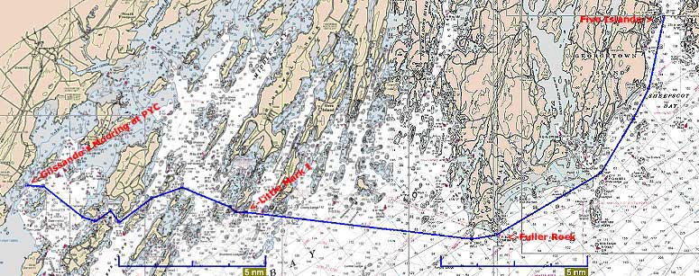
7/2/04
 Friday
morning, we hoped to get underway around 0800 to allow plenty of time to
make the 27u mile trip to our planned first destination: Five
Islands, a couple miles up the Sheepscot River. We had been there
back in 2001 on our way to Pemaquid, and had fond memories. The
atmosphere in the morning was extremely thick and somehow threatening,
and NOAA was forecasting possible severe weather for the day--when was
not exactly clear, and it sounded as if thunderstorms could possibly
come through even in the morning. I carefully considered whether
or not to leave, but the western sky was not overly threatening in
appearance, so I decided we might as well head out and just be prepared
should something happen later. Friday
morning, we hoped to get underway around 0800 to allow plenty of time to
make the 27u mile trip to our planned first destination: Five
Islands, a couple miles up the Sheepscot River. We had been there
back in 2001 on our way to Pemaquid, and had fond memories. The
atmosphere in the morning was extremely thick and somehow threatening,
and NOAA was forecasting possible severe weather for the day--when was
not exactly clear, and it sounded as if thunderstorms could possibly
come through even in the morning. I carefully considered whether
or not to leave, but the western sky was not overly threatening in
appearance, so I decided we might as well head out and just be prepared
should something happen later. |
|
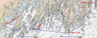
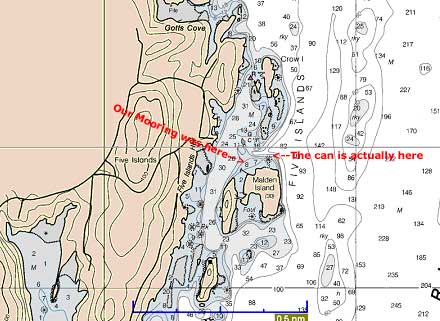
Click to enlarge
|
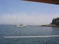
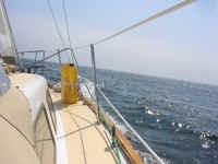 We
departed at 0810 under motor with the main up, with no wind. We
motored our usual route out past Hope, Chebeague, and Little Mark
Islands; once we got outside Little Mark, a nice southerly wind had
picked up, at about 12-14 knots. It was perfect for a close reach
across the remains of Casco Bay, which we enjoyed at speeds of 5-6 knots
for most of the way. Throughout the morning, I kept a wary eye on
the western sky and some building clouds t here, ready to make a move
should any of the weather approaching appear severe at all.
Fortunately, it appeared that the clouds were tending to move more along
the shore, rather than straighter out to sea, so for now we were all
set. We
departed at 0810 under motor with the main up, with no wind. We
motored our usual route out past Hope, Chebeague, and Little Mark
Islands; once we got outside Little Mark, a nice southerly wind had
picked up, at about 12-14 knots. It was perfect for a close reach
across the remains of Casco Bay, which we enjoyed at speeds of 5-6 knots
for most of the way. Throughout the morning, I kept a wary eye on
the western sky and some building clouds t here, ready to make a move
should any of the weather approaching appear severe at all.
Fortunately, it appeared that the clouds were tending to move more along
the shore, rather than straighter out to sea, so for now we were all
set. |
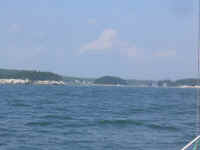
 We
sailed all the way around Cape Small and inside Fuller Rock, but
at this point the wind became very light, leaving behind a confused
choppy sea that shook any remaining wind right out of the sails.
After giving it the ole' "college try", I decided to give in
and motor, so that we could get where we were going before any
thunderstorms came through: the weather still looked threatening
enough on the horizon, though the day was sunny, hazy, and pleasant
otherwise. But it just seemed like that kind of a day, so
prudence ruled. We
sailed all the way around Cape Small and inside Fuller Rock, but
at this point the wind became very light, leaving behind a confused
choppy sea that shook any remaining wind right out of the sails.
After giving it the ole' "college try", I decided to give in
and motor, so that we could get where we were going before any
thunderstorms came through: the weather still looked threatening
enough on the horizon, though the day was sunny, hazy, and pleasant
otherwise. But it just seemed like that kind of a day, so
prudence ruled. |
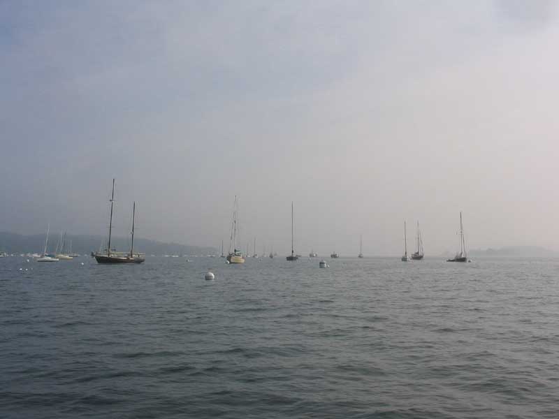
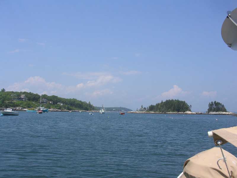
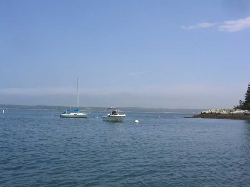
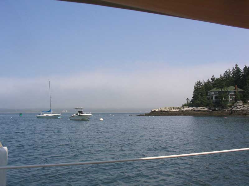
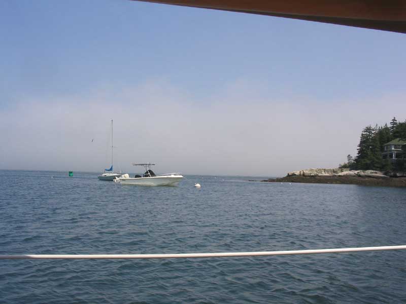
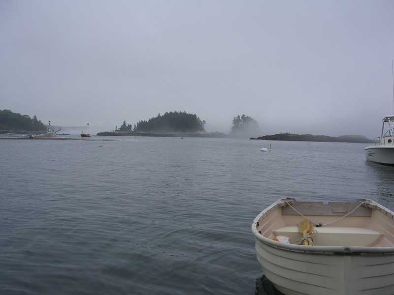
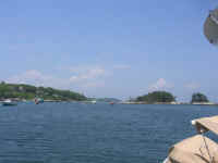
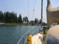
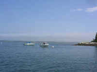
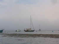
 We
arrived at Five Islands and picked up one of the free moorings in the
small, cozy harbor. Shortly after we arrived, I could feel the
wind picking up a bit, and, looking out towards the Sheepscot River
running just past the narrow entrance to the harbor, I watched as fog
quickly blew in on the fresh breeze, obscuring all visibility outside
the harbor. We had gotten in just in time, apparently. The
afternoon passed uneventfully, with the fog coming in and out depending
on the wind strength at any given time. Tall clouds dotted the
western sky all day, with a few minor showers but no real thunderstorms,
despite the threatening appearance. You just never know. We
arrived at Five Islands and picked up one of the free moorings in the
small, cozy harbor. Shortly after we arrived, I could feel the
wind picking up a bit, and, looking out towards the Sheepscot River
running just past the narrow entrance to the harbor, I watched as fog
quickly blew in on the fresh breeze, obscuring all visibility outside
the harbor. We had gotten in just in time, apparently. The
afternoon passed uneventfully, with the fog coming in and out depending
on the wind strength at any given time. Tall clouds dotted the
western sky all day, with a few minor showers but no real thunderstorms,
despite the threatening appearance. You just never know. |
|
|
|
|
|
|
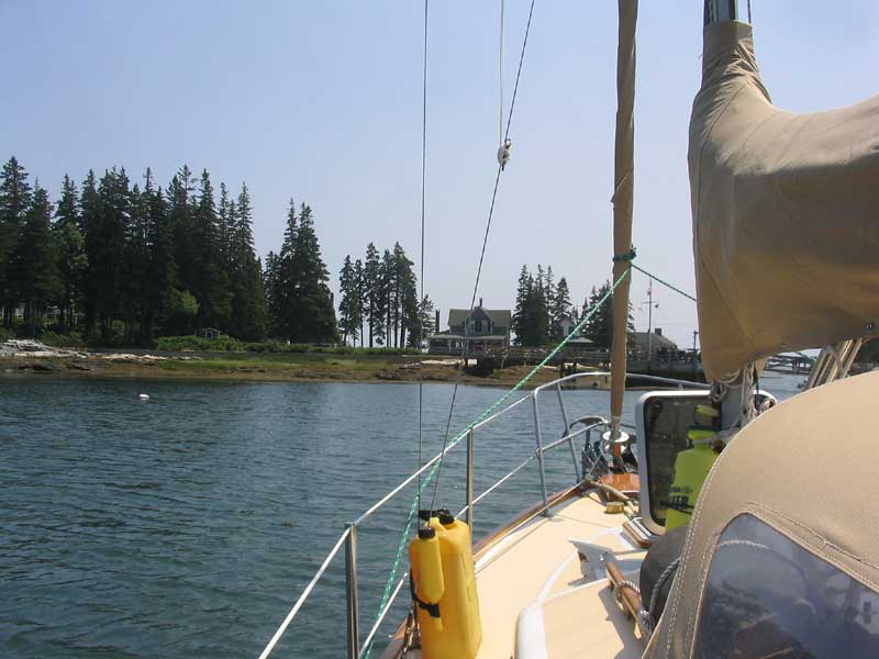
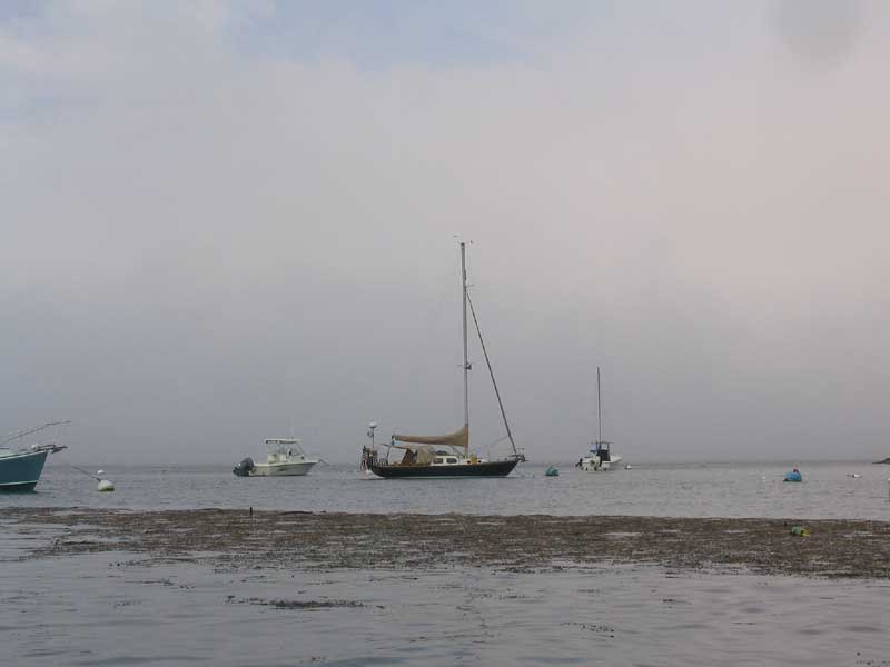
 There
was a huge amount of seaweed, kelp, and debris in the water,
particularly in the harbor, since it had just been a full moon with
spring tides--real beach-washers and drainers. It was sort of like
being in the Sargasso Sea, and the weed was so thick and constant that I
almost couldn't row through it. It seemed as if I could have
gotten out of the dinghy and walked across. There
was a huge amount of seaweed, kelp, and debris in the water,
particularly in the harbor, since it had just been a full moon with
spring tides--real beach-washers and drainers. It was sort of like
being in the Sargasso Sea, and the weed was so thick and constant that I
almost couldn't row through it. It seemed as if I could have
gotten out of the dinghy and walked across. |
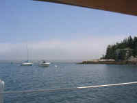
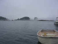 I
spent some time rowing around the harbor, taking pictures and just
enjoying the sights. It was great fun to watch the fog, which
would ooze into the harbor around the islands in mere seconds, only to
clear again moments later. And so it went for most of the
afternoon and evening. I
spent some time rowing around the harbor, taking pictures and just
enjoying the sights. It was great fun to watch the fog, which
would ooze into the harbor around the islands in mere seconds, only to
clear again moments later. And so it went for most of the
afternoon and evening. |
|
|
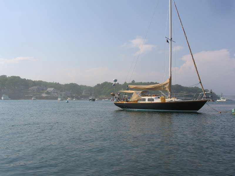
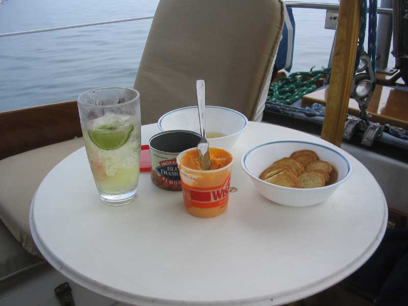
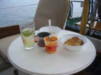 As
our first real cruise of the year, this was our first opportunity to
audition the new cockpit
table I built during the spring. It was an unqualified,
fantastic success: moments after setting it up, both Heidi and I
were marveling at its awesomeness, and wondering aloud how we ever
managed without it. The height, position, and size were perfect in
every way, and it was a cinch to set up and break down as needed.
In addition, its position and height made it a perfect arm rest when
sitting at the aft end of the cockpit facing forward, as we tend to
do. Build one of these things: fantabulous. As
our first real cruise of the year, this was our first opportunity to
audition the new cockpit
table I built during the spring. It was an unqualified,
fantastic success: moments after setting it up, both Heidi and I
were marveling at its awesomeness, and wondering aloud how we ever
managed without it. The height, position, and size were perfect in
every way, and it was a cinch to set up and break down as needed.
In addition, its position and height made it a perfect arm rest when
sitting at the aft end of the cockpit facing forward, as we tend to
do. Build one of these things: fantabulous. |
|
Continue with the
log>
|
|